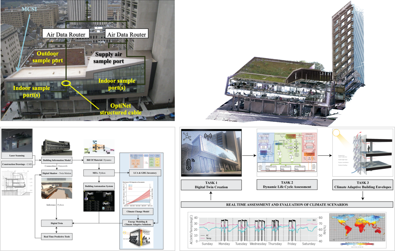
2024.08–Present: Deep Learning-Based Semantic Segmentation of LiDAR Point Clouds for Civil Infrastructure
Developing a modular deep learning framework for high-resolution terrestrial LiDAR scans to automate semantic and instance segmentation of complex civil infrastructure components. The system integrates panoramic imagery projection, cross-modal supervision using Vision–Language Models (e.g., Grounded-SAM), and geometry-aware descriptors such as surface normals and point density. These capabilities support the creation of highly detailed Digital Twin models for structural analysis, FEM meshing, real-time asset monitoring, and long-term infrastructure management.